By Demetrios Constantinos Andrianis
Mytilene Lesbos
In antiquity Mytilene was separated from Lesbos by a small channel. Εύριπο or Euripus is a used when referring to a channel. The channel allowed ancient 3 rower or more sail boats called Trireme. Boats that passed were 34 meters and had depth of 4 meters. Mytilene exhibited comparable characteristics to Venice Italy. The areas of the city that were densely populated connected the two bodies of land with marble bridges. They usually followed a curved line. The straight begin at the old market called Apano Skala. It was also close to Metropolis Street and ended at the Southern Harbor. One could argue that the channel transversed what is now called Ermoy Street. Over time the straight began to collect silt and earth. There was also human intervention for the protection of the Castle of Mytilene the straight eventually filled with land. Below is a picture of what Mytilene might of looked like around the 4th century BC.
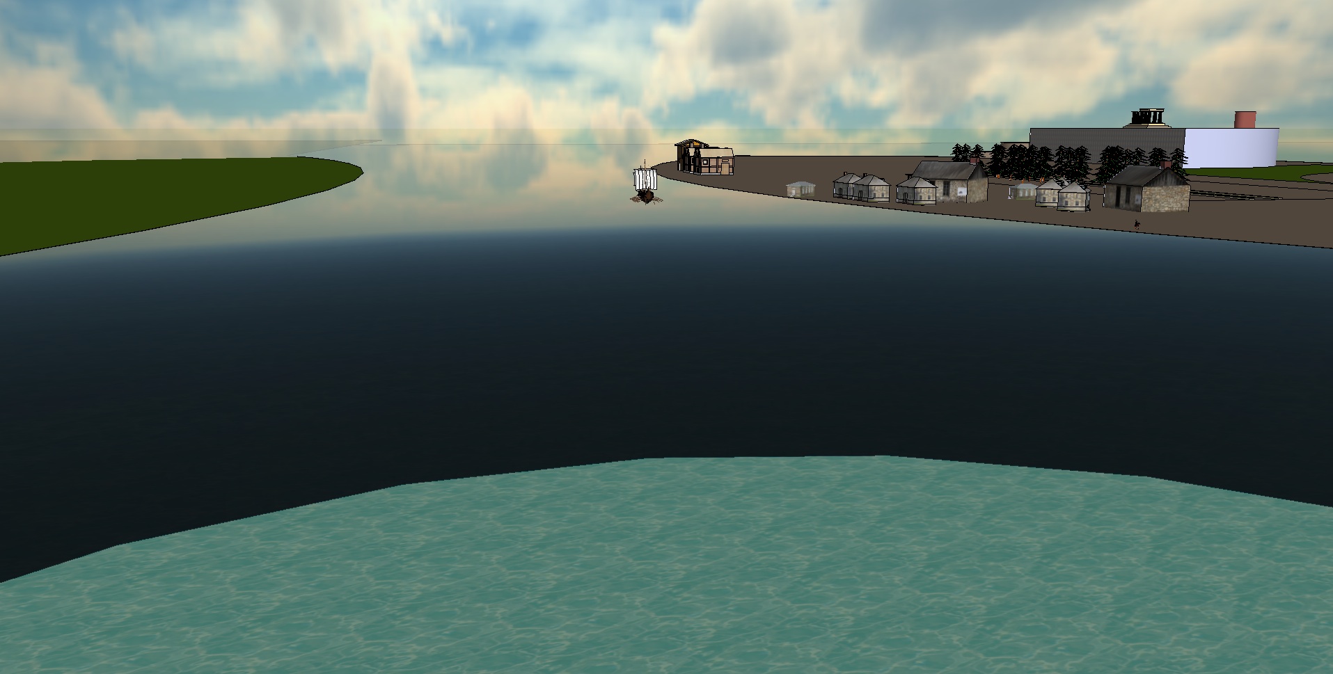
The areas of the city that were densely populated connected the two bodies of land with marble bridges. They usually followed a curved line. The straight began at the old market called Apano Skala. It was also close to Metropolis Street and ended at the Southern Harbor. One could argue that the channel transversed what is now called Ermoy Street. Over time the straight began to collect silt and earth. There was also human intervention for the protection of the Castle of Mytilene the straight eventually filled with land. According to a map of Mytilene created in 1597 by the Venetian Giacomo (Jacomo) Franco. There was still a separation between the island Mytilene (Kastro) and Lesbos[1].
Around 1733, the harbor in Mytilene was under developed. The Janissary soldiers were headquartered at Castro with the Qadi, a French consulate was also stationed there. Did any visitors make any Paintings during this period? The long existent channel or straight that separated Mytilene was now gone[2].
Possible theories are the elite Janissary soldiers of Sultan considered the military weakness of the channel of that nature close to Castro. Through the years the channel may have been filled with rocks, dirt, and debris to protect the military fortress that was constantly under attack by foreign forces. Some Ottoman maps before the Venetian map refute the channel but further investigation has to be done to make a conclusive argument. See other maps below. Another question for historians: Has the island sea level risen or dropped since the 1400's and by how much? Theoretically sea level has to have risen.
The island was constantly under attack by Venetians during the 16th and 17th centuries. Notable battles occurred during the Sixth Ottoman–Venetian War or the Morean War (1684–99). A naval battle took place on the 8 of September 1690 at Mytilene. Another battle involving Lesbos was during the Russo-Turkish War on July 1770. It was the Battle of Chesma.
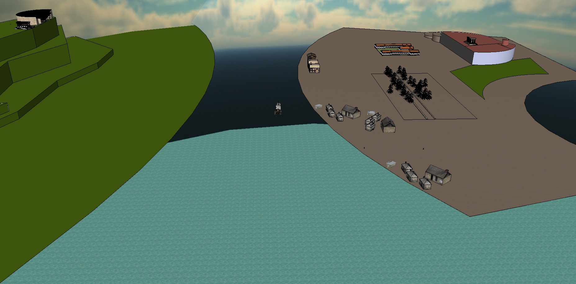
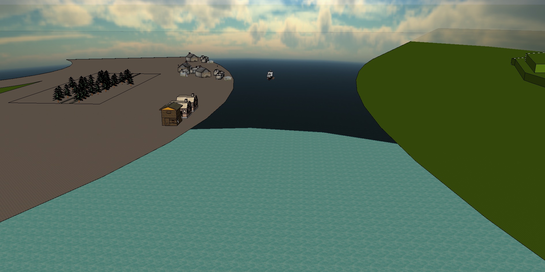
Around 1800 a traveler named Guillaume Antoine Olivier visited Lesbos. He made some important observations. First he noticed that a channel separating Lesbos from Mytilene that once existed was filled with land. There was a north and south harbor. The south harbor was only for Ottoman ships it was shallow. Small merchant ships used the north harbor. Military ships and European ships for commerce were allowed off the south port further away close to modern Sorada. During the winter the wind was so strong that sometimes boats would break and sink or the cables would have to be cut and the ship set sail immediately in order to avoid damage. Most of the commerce was done in the two main Gulfs: at Gera and Kalloni they were Port Jero and Port Kalloni. According to historians they were magnificent[3]. See Gera Below
Gera Lesbos
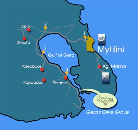
'''Gera''' '''Yera''' or '''Jero'''Greek Γέρα is an ancient city on the island of Lesbos. The name Gulf of Gera or Bay of Gera is derived from the city. The port in the Gulf of Gera was referred to as Port Olivier or Port Jero the port is in the city of Perama, Lesbos. It once stood as one of the largest ports of the island. According to scholars the ancient name may have been Portus Hieraeus; because Pliny the Elder mentions a Lesbian city called Hiera, which was extinct before his time[4]. The current name is used for a Municipality, a municipality is similar to a county.
Bay of Gera
The Bay of Gera encompasses a large body of land with many villages which differ from the municipality (county) but are important in the history of the Bay of Gera and the name Gera, Lesbos. Usually when referring to Gera, the entire region encompassing the Gulf is considered. The local people that are from a village close to the Gulf of Gera are referred to as Geragotes. The main port today is referred to as Perama. The name has changed throughout history on maps it may have been any of these names; Ieremidia, Gieremia, Geremia, Lichremadia, Maliae, Iero, Hiera, Giera, Keramia, Iera, Gera, Eleon, Olivier[5].
Pliny the Elder was a roman historian, scientist and author from around 23 AD. He spent most of his time studying geographic phenomena. He wrote in his book that there was an ancient city on Lesbos known as Hiera. This may have been a village around the Bay of Gera called Gera. It was the head of Port Olivier[6]. Scholars could argue that the name is derived from the greek goddess Hera. There is evidence that the island of Lesbos followed the Cult of Hera during the time of Sappho around the 7th century B.C[7][8]. It could of referred to the place of Hera. Also, a phonetically similar name in Greek mythology belongs to Hiera. She was the mythic founder of the city of Pergamum which is roughly 90 kilometers from the Gulf of Gera. One of the Thermal Baths was built close to the remains of a temple of Hera.
Recall that the Janissary soldiers were headquartered at Castro with the Qadi, Mytilene was the main fortress and forbidding to commercial shipping activity. There were two main harbors on the island of Lesbos, they were located within the Gulf of Kalloni and the Gulf of Gera around the 18th century. Around Sept 1733 travelers set sail for Constantinople. They visited the Port in the Bay of Gera at that time it was referred to as the Bay of Jero. The travelers learned that the name Port Olivier was derived from the Franks. It is also the french word for olive. They witnessed the Port of Jero being more magnificent then that of Mytilene. Mytilene had a less developed harbor[9].
A possible explanation for Gera and Kalloni being the main harbors could again be attributed to military strategy. It is very difficult to propose an attack on the gulf of Gera due to the nature of the gulf. It was a safe place to store Military ships. The Gulf had a narrow passage for entrance and it could easily be guarded against attack. Mytilene Castro, Molyvos Castro and the final built exclusively by the Ottomans Sigri Castro were all open to the sea. The inner gulf was safe because it was not susceptible to attack by vessel. When the Ottomans took Constantinople, they found a way around the chains, which was to bring the ships on Land. The Jani-Cheri learned from this decisive military victory and protected themselves from possible attack.
In the Capitol, Mytilene around 1850 according to Maria Panagopolo's Thesis there were 300 small workshops that produced different products ranging from soap, olive oil, leather tanning and other goods. According to her thesis the capitol was still the main industrial epicenter due to it's close proximity to Castro. There was a Greek and Turkish market. Later the industrial revolution converted small workshops into factories. It would make sense that the Ottoman Government infrastructure would prefer commerce close to Castro for tax purposes. Recall that our explorers noted that the harbors were not as developed as Port Jero before this time. See The Industrial Revolution of Gera 1800 until it's decline. Around 1800 Olivier estimated the population at Castro or Metelin to contain two or three thousand Greeks, three or four thousand turks and 30 or 40 jewish families. He also estimated the entire population of Lesvos to be roughly 40,000 inhabitants half greek, half turkish, the turkish declined closer to the 20th century. Roughly 15 percent of the islands population inhabited Mytilene. Today 34% of the population lives in Mytilene [3].
During the early 19th century the steam ship was invented followed by the industrial revolution of the 1850’s. Towards the end of the 19th century the Gulf of Gera was an industrial epicenter. Greece was at war with the Ottoman Empire in other parts while the economy of the local region Gera flourished. The area was magnified with Olive Oil Production Factories, Soap Factories, and a Leather Tanning Factory. The area was also full of Storage facilities close to the dock and Offices for local and international commerce. See The Industrial Revolution of Gera 1800 until it's decline.
Around 1843 The Church of England Magazine published an article discussing Port Jero. The Springs located on the Bay of Gera were mentioned, they contained two roofed buildings and they were frequented by the locals[10]. Fractured plates and an endless history of Volcanos geothermal activity on the island of Lesbos allows for the existence of Hot Springs. There are many hot springs the oldest is at Thermi. The hottest is at Polichnitos which is also the hottest in europe. There are also the Lisvori Springs but the most romantic is at Efthalou, near Molyvos. The one at the Gulf of Gera a small distance outside of Mytilene was frequented by Sir Winston Churchill during the 20th century. Both Eleftherios Venizelos and Sir Winston Churchill characterized the Bay of Gera as a miracle of nature[11]. Odysseas Elytis was the 1979 Nobel Prize winner in Literature. His mother was from Gera and both parents from Lesvos.
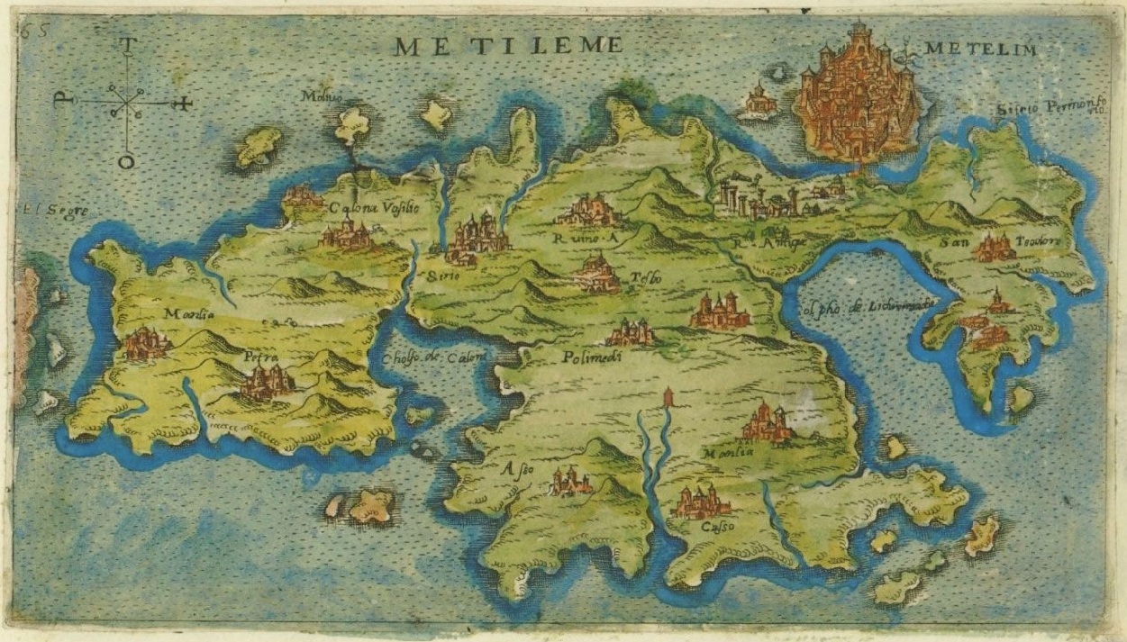
Other Maps of Lesbos
1528 AD Map of Lesbos and Ayvalik Turk Piri Reis
1597 Map of Lesbos by the Venetian Giacomo (Jacomo) Franco
1724 October 24 Map of Lesbos
1771 Map of russian navy attack on Mytilene 2-4 novembee
External Links
Greek History in Greek Use translatior
Painting of Metelin 1718
Population of Mytilene 19th Century 1855 M'Culloch̓s Universal Gazetteer
References
1. PORT MYTILINIS-YESTERDAY AND TODAY
2. A Voyage Into the Levant ... Containing the Ancient and Modern ..., Volume 2 By Joseph Pitton de Tournefort 1741 The Library of the University of California Davis
3. Olivier G.A. "Travels in the Ottoman empire, Egypt, and Persia, undertaken by order of the government of France. During the first six years of the Republic" The French Government London 1801
4. Dictionary of Greek and Roman Geography (1854) ] accessed August 7, 2014
5. Ο Κόλπος Γέρας και οι υφάλμυρες υγρές περιοχές του σε κίνδυνο Παρασκευή 30 Δεκεμβρίου 2011
6. The Natural History of Pliny, Volume 1 By Pliny (the Elder.)
7. Shield, Emily Ledyard "The Cults of Lesbos" Johns Hopkins University. 2012
8. Robbins, Emmet "Thalia Delighting in Song: Essays on Ancient Greek Poetry" University of Toronto Press. 2013
9. Thompson, Charles "Travels through Turkey in Asia, the Holy Land, Arabia, Egypt, and others" PITTSBURGH University of Virginia Press 1835
10. Sanderson A.R. Banbury O. "Church of England Magazine Volume 15 No. 420 Auguest 26, 1843" London accessed August 7, 2014
11. Eναλλακτικά σενάρια σχεδίων ανάπτυξης για ενίσχυση του ιαματικού τουρισμού! 26/06/2013